Centreville

Designated Cahaba Blueway Access

PDF Map | Closest River Gauge | All Cahaba Gauges | Swim Guide Access Point Hiking Trail
×Access Point

835 Walnut St
Centreville, AL 35042
Get Directions →

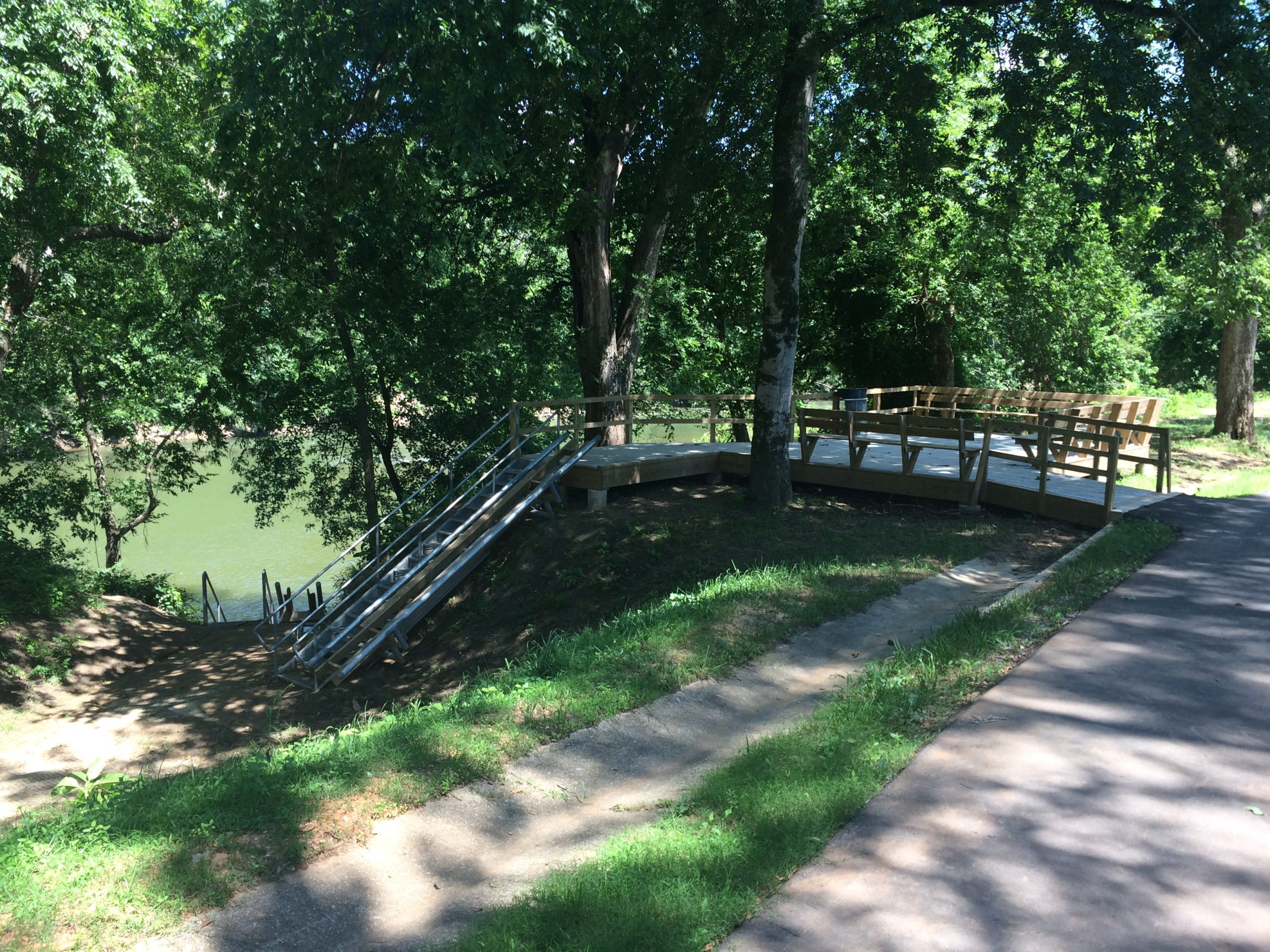
Opened in 2019, the Centreville access represents the newest improved access developed on the Cahaba River.  Parking is available in front of the Bibb County Chamber of Commerce (the old railroad depot building that fronts onto Old Hwy. 82) or at a smaller parking area you will find behind Bibb County High School about 220 yards down the gravel drive to the left of the Chamber of Commerce buildingl.  If you park at the Chamber of Commerce, the walk to the access point is about 200 yards down the riverwalk pathway.  If you park at the other location, it’s a much shorter trek of about 20 yards to the access.  The access itself is a set of stairs with canoe slide rails to aid in getting your boat down the steep slope.

Area Restaurants, Lodging, and Tourism Resources:

https://bibbchamber.org

https://www.tourwestalabama.com/county-overall/bibb-county/

+River Segment - 13.3 miles

As you begin your trip along this segment, paddle through the shoal to the left of the large sand island, and as you pass this way, keep an eye out for the "V" shaped rock formation between the island and the left bank. This is likely an ancient weir built by the Native Americans to catch fish. This shoal lies at the "Fall Line," which is the last place you will encounter the 250+ million year old hard rocks of Alabama's uplands. Below this point, the river's character changes dramatically. You will notice that the river takes on wide meanders, bending back and forth, and the rocky shoals above the Fall Line are now replaced by broad gravel bars and beaches. You are now in Alabama's Coastal Plain region, and the rocks here are much younger (80-100 million years old) and softer than those above the Fall Line. The river here has many different plants (and some animals) in and around it than exist above the Fall Line. The gravel bars are considered private property by most of the landowners, so stay on the water and do not trespass. From Centreville, it's 13.3 miles to the Harrisburg Road access, and apart from maintained pastures, there is little sign of human activity. The best distance reference along the way is Cooper Island, signaled by a smaller channel of the river that splits off to the right at about mile 9.2. The upper end of that channel is 4.1 miles from the Harrisburg Road access and where that channel joins back to the river is 2.5 miles from the access. Be sure to stay to the left in the main river channel here. If you split the trip in two days, you will need to secure permission from a landowner to camp on or to access the river through private property. Under no circumstances should you trespass on private property to camp or take out. This and the lower sections of the river should be paddleable throughout the year, but be sure not to float them when the water is too high. The Harrisburg access is an unimproved access on the left bank under the Harrisburg Rd. bridge.

+Gallery